News | 29 July 2020
Cyclomedia as a partner in the GeoSmartChange project
The first model region chose Cyclomedia as part of the government’s funding programs in Germany!
In the course of the GeoSmartChange project, the model region “Emscher-Lippe” is to be developed into a “smart region”, which includes the cities of Bottrop and Gelsenkirchen as well as the district of Recklinghausen. The aim of digital transformation is to design more efficient processes, achieve cost savings and provide an improved citizen service. The persons responsible have chosen Cyclomedia as a partner to implement this project!
An essential part of this project is the use of “artificial intelligence” to build a “digital twin” in the region.
Cyclomedia's digital twin as a data basis
Many administrative procedures in municipalities and concerns of citizens require up-to-date knowledge of the specific local circumstances in the city.
The project team of the model region Emscher-Lippe, consisting of those responsible from the cities of Bottrop, Gelsenkirchen, the district of Recklinghausen, the Westphalian University and the Institute for Innovation Research and Management, have decided for high-resolution, accurate and geo-referenced 360° panoramic images as a tool for implementing the project and searched by means of a European tender for a suitable partner for the digital capture of the environment.
They chose Cyclomedia!
Thanks to the digital twin of the region, which we provide through image surveillance and data analysis, municipal employees can now easily get a comprehensive and decision-relevant picture of the situation from the office. The intensive exchange of the local specialist administrations should be exemplary for a change process to the Smart Region, which can also be transferred to other fields and regions. The aim is to exploit unused digitization potential with regard to the use of the technology, to initiate groundbreaking and sustainable changes for digital urban development and to significantly accelerate digitization processes through the subsequent transfer to other locations.
We look forword to cooperation!

Funded by the Ministry of Economy, Innovation, Digitization and Energy of the State of North Rhine-Westphalia.
The different areas of application of the digital twin
By providing a high-resolution and georeferenced “digital twin” of the region, the GeoSmartChange projects generates added value for the community, which has an impact on the work processes of the employees of the municipalities as well as on the residents. Potential applications of the 360° panoramic images extend across the relevant departments for economic development, the environment, urban planning, surveying and cadaster, building regulations and building administration, traffic, city cleaning and the fire brigade.
AI as an important tool on the way to the Smart Region

In addition to the captured data, Cyclomedia will also provide the project team with various cadastral data that are generated based on the image and laser scan data. While the images were initially used for visualization and measurements, we have further developed Cyclomedia’s solutions. They now serve as an important tool in the development of a city into a Smart City or a region into a Smart Region, using automated object recognition.
By using algorithms, Cyclomedia generates comprehensive cadaster based on the 3D Cycloramas. For the GeoSmartChange project, we will extract traffic signs, street lighting and traffic lights from the image and laser scan data and thus create digital cadasters.

Cyclomedia as the ideal partner on the way to the Smart Region
Cyclomedia provides the GeoSmartChange project team with 3D Cycloramas and data insights from the Emscher-Lippe region for the implementation of the project. The persons responsible have access to the data as well as visualization, analysis and documentation functionalities both within the framework of the integration into existing GIS systems and through the Cyclomedia viewer Street Smart. GIS expertise is therefore not a requirement when using the data! In addition, no change to the current IT infrastructure is required to integrate the new database directly into everyday work processes.
The “Starter Kit” supplied by Cyclomedia enables all project participants, no matter where they are in the field of digitization, to share the status quo with each other and to define and implement common, next steps. Real digital work without media breaks simplifies communication within the large-scale project, which relates to the entire Emscher-Lippe region. In addition, the project results and the resulting benefits for all local authorities in the region are still tangible during the project.
Cyclomedia and the Institute for Innovation Research and Management (ifi) will support the municipalities in the project are in the transformation process.
GeoSmartChange demonstrates how a cooperative regional digitization process of cities and communities can be successfully designed with very different requirements. We are happy to be part of the project!

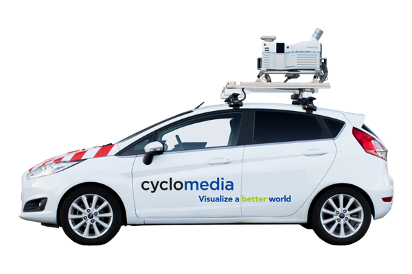
Since July 27, 2020, our drivers have been in Bottrop and Gelsenkirchen as well as in the Recklinghausen district to take high-resolution, accurate and georeferenced 360° panoramic images of the area.
The capturing is expected to be completed by November 15, 2020.

