Blog | 01 juni 2021
Property Appraisal
Performing tax assessments is demanding. Cyclomedia makes it easier.
Performing a review of properties for tax assessment purposes is challenging. Property site visits incur transportation and labor costs. They also take up valuable time that could be put to better use. Even the most carefully performed on-site property visit can still not be 100% accurate, leading to a potential increase in the number of property appeals.
Cyclomedia’s Tax Assessment imaging solution helps solve these problems. Our data-rich, street-level high definition (HD) 360° imagery and cutting-edge measurement tools combine to reduce assessment costs, increase accuracy, and ensure that deadlines are met.
Decrease costs and increase efficiency with desktop field assessments
Cyclomedia’s up-to-date, HD street-level imagery and GeoCycloramas™ are accessible from the cloud via our Street Smart™ interactive web viewer. The imagery meets and exceeds IAAO standards by overlaying measurement functionality and allowing remote evaluation of property grade and condition. Cyclomedia imagery and data provides the following benefits:
- Streamline costs by performing audits and field assessments remotely
- Maximize onsite audit efficiency by planning what to focus on in advance
- Improve assessment accuracy by viewing a selected property from multiple angles
- Increase the number of audits that can be performed with geolocational searches
- Provide visual evidence in defending values during appeals
IAAO compliance
IAAO Mass Appraisal of Real Property standard, revised in 2017, states that:
“Provided that initial physical inspections are timely, completed, and that an effective system of building permits or other methods of routinely identifying physical changes is in place, jurisdictions may employ a set of digital imaging technology tools to supplement field re-inspections with a computer-assisted office review. These imaging tools should include the following:
- Current high-resolution street-view images at a sub-inch pixel resolution that enables quality grade and physical condition to be verified.
- Orthophoto images with a minimum 6” pixel resolution in urban/suburban and 12” resolution in rural areas, updated every 2 years in rapid growth areas, or 6–10 years in slow growth areas.
- Low level oblique images capable of being used for measurement verification four cardinal directions with a minimum 6” pixel resolution in urban/suburban and 12” pixel resolution in rural areas, updated every 2 years in rapid growth areas, or 6–10 years in slow growth areas.”
Cyclomedia imagery meets and exceeds the IAAO 3.3.5 Requirements. Cyclomedia’s current high-resolution street-view images at a sub-inch pixel resolution enables verification of quality grade and physical conditions. Our solution also provides integration with both orthophoto images and low-level obliques. Our 360° panoramic GeoCycloramas literally transform tax assessment workflows by allowing you to perform remote assessments that save time and money.

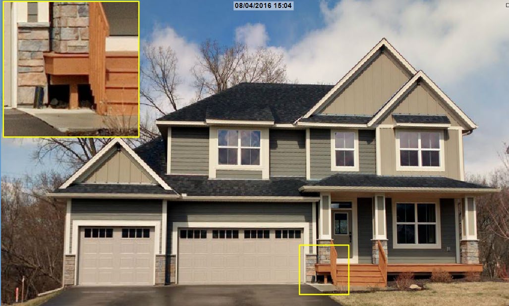
HD GeoCycloramas allow users to zoom in closely to view details of the property.
Improve accuracy and boost revenues with precise measurements
Cyclomedia’s Street Smart web viewer includes an array of tools to measure all aspects of
a property. These tools allow assessment professionals to:
- Verify CAMA data in a highly efficient, highly accurate manner
- Confirm that sketches and CAMA data are accurate with detailed height, width, and surface area measurements
- Experience proven return on investment (ROI), efficient workflows, and optimized verification processes
- Eliminate assessment inaccuracies due to limited resolution of aerial imagery
- View the surrounding neighborhood to see if there are issues that might impact the value of the subject property, such as neighborhood obsolescence
Street Smart’s intuitive, easy-to-use measurement tools ensure high quality, accurate property assessments by removing the typical barriers: extensive heights, unique architecture, and natural features that impede on-site assessments.
Imagery from Cyclomedia can be easily integrated with third-party software via our API, as shown here in Philadelphia’s Atlas tax assessment application.
Reduce taxpayer concern with highly accurate, precise, historic data and imagery
Cyclomedia’s Street Smart integration includes the ability to update imagery and verify assessment data every year. This reduces taxpayer concerns by:
- Refuting property appeals with historic and current images
- Preventing complaints with reports showing the detailed historic measurements
- Validating property improvements with image capture of multiple angles
- Deterring property appeals with high resolution imagery showing grade and condition
Cyclomedia’s GeoCyclorama imagery, measurement, and reporting tools assist in defending challenges to tax assessments, allowing tax assessment departments to focus on quality and efficiency.
Additional Cyclomedia benefits
Cyclomedia’s 360° imagery, LiDAR data capture, and Street Smart web viewer and measurement tools can reduce the burden on tax assessment departments and increase revenues by:
- Streamlining the overall data collection
- Reduce field visits and associated costs
- Increasing the accuracy of property assessments and market analysis
- Improving the quality of property assessments
- Removing taxpayer objections to tax assessments
- Providing imagery and data that is of value to other agencies therefore spreading the cost across different department budgets
- Existing integrations available to CAMA, GIS, desktop review and web-based applications