Public Safety
We’re changing the way first responders respond
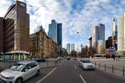
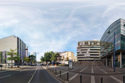
Cyclomedia improves both the pre-planning and actual response time for first responders by offering a worldview beyond what 2D maps or aerial photographs alone can provide. Our GeoCycloramas™ provide high-resolution, street-level views of buildings, streets, and critical infrastructure.
With high resolution, intense street-level details and dense LiDAR point clouds, Cyclomedia provides a vital, powerful tool for emergency response times.

E911 is all about location, location, location. Before the proliferation of smartphones, most E911 calls originated from landlines at street addresses. But today, wireless phones make 80 percent or more of the total calls. And that percentage is growing. In addition, a large percentage of wireless callers can’t clearly identify their locations, presenting challenges for dispatchers at Public Safety Answering Points (PSAPs). With access to Cyclomedia's data insights, PSAP personnel can clearly see where the caller is calling from and relay location details directly to first responders.
Tactical and strategic planning are critical for fire and police calls, situational awareness, and events. Know before you go. Be fully prepared for the unexpected. Enable faster decision making for a more effective response.
Blog: Public Safety in Smart Cities

From 911 phone operators to law enforcement officers, each moving part of Public Safety organizations responds to emergencies and issues to keep everyone safe. But what happens when they simply do not have the resources to efficiently respond to calls?
With Public Safety organizations being at the center of constituent’s wellbeing, it is crucial that Smart City technologies are adopted to aid in emergency response. Cyclomedia’s GIS-driven solutions give organizations the data and situational awareness they need to locate callers and be prepared for potential location-specific hazards.
Let's connect!
Expect the unexpected

When callers are unable to clearly articulate their location, significant challenges are presented for dispatchers at Public Safety Answering Points (PSAPs), who rely on accurate location information to coordinate emergency responses effectively. By providing PSAP personnel with detailed visual information about the caller's location, such as street views or building layouts, Cyclomedia enables dispatchers to accurately pinpoint the caller's whereabouts and relay this information to first responders.
Not only does Cyclomedia’s Public Safety solution assist PSAPs in locating callers, but it also allows first responders to be prepared for unexpected hazards or obstructions once they arrive on scene. For example, if there are residents in a building with special needs who need assistance during an evacuation, imagery and data can help first responders determine whether or not their building is handicap accessible.
What other products will help improve quality of life for your citizens?