Blog | 19 juni 2023
Blog: Traffic Sign and Pavement Striping Conditions
Cyclomedia’s modern solutions help local government and transportation departments analyze traffic signs and pavement striping conditions
Cyclomedia, the leading roadway asset data provider to state and local agencies, understands the complexities our customers face. In a world that is quickly evolving, it is often difficult to keep up with the demands of maintaining an entire roadway network. With our ‘Condition Assessment for Traffic Signs and Pavement Striping’ product, we provide our customers with the most accurate precision imagery and data analytics in the market today, so they can assess their entire network from behind their desktop.
Why do local government and transportation networks need Cyclomedia?
Recently, the Federal Highway Administration (FHWA) released a rule requiring these departments and organizations to identify a plan to maintain and report on the condition of their pavement striping and traffic signs, as it relates to LiDAR retro-insity measures. This rule gives organizations four years to identify their plan to maintain all their pavement striping and traffic signs at acceptable levels. Managing these public assets is vital to ensuring the safety of our roadways. However, creating this plan requires having a complete and up-to-date inventory of roadway assets and their conditions, so organizations can recognize their ‘problem areas’ and confidently create the most optimal plan.
In an era where public agencies are challenged to do more with fewer resources and shrinking budgets, Cyclomedia’s 360° street-level imagery, automation and AI technology offers a solution to solve those challenges.
How does it work?
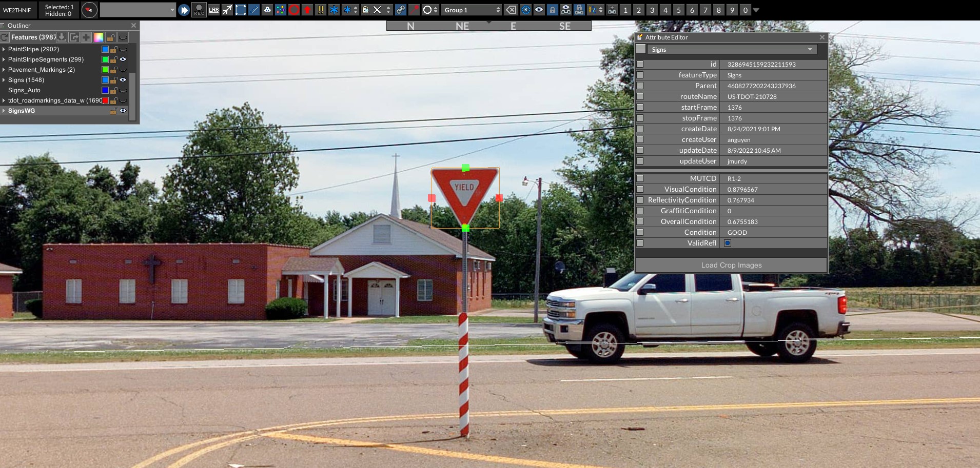
We use a combination of RGB visual scoring based upon a trained machine learning model, as well as normalized intensity data from our LiDAR sensor. This combined scoring system allows us to provide an overall condition score of these assets on a network scale, with an unmatched density compared to traditional manual approaches. Our software automates a portion of the data analysis process by highlighting valuable insights from condition collection attributes and assisting in highlighting problem areas. The information is delivered as a dataset, making it easy for departments to focus on the maintenance of traffic signs and pavement striping conditions. This vastly reduces the need of sending personnel into the field to manually inspect the condition of these assets across thousands of miles across their network, saving DOTs both money and time.

Increase in demand
Prior to the new requirement being released, Tennessee DOT requested a pilot to evaluate a potential solution to analyzing sign and pavement striping conditions in regard to reflectivity and visual condition. When the rule came out late in 2022, TDOT and Cyclomedia were excited about the results. Once the rule was delivered, we saw increased interest with Utah DOT requesting information on what we are doing to help DOTs find a solution to the new ruling. Our customers understand how important these safety assets are to the constituency as well as the innovations that are happening in the automotive world such as autonomous cars.
Knowing the condition of assets is an integral part of ensuring safe communities. Being able to assist our customers in solving this network-wide problem while reducing the time and money our customers have to expend is why I love this job.
- Cyclomedia Senior Product Manager, Marion Spencer
Experience in approaching solutions
With our experienced team, Cyclomedia’s goal is to solve problems associated with asset condition collection and analysis and measure the success of any organization’s maintenance plan. There is a compelling story to tell about how organizations who are struggling to efficiently inventory asset condition can use our superior collection techniques for assets and get their reflective condition too. By providing detailed insights about a roadway network, Cyclomedia’s solution allows our customers to make calculated and informed decisions regarding their roadway network.
