Surface insights for safer, more informed infrastructure decisions
Use reliable geospatial data to assess pavement condition, identify surface types, and understand flooding risk—supporting safer planning, accurate cost estimation, and more resilient infrastructure.


Build clarity into every pavement and surface decision
Cities and agencies need accurate, scalable insights into pavement quality and surface characteristics. Cyclomedia provides consistent imagery and LiDAR-based datasets that help teams prioritize maintenance, plan underground works, and prepare for environmental risks with defensible geospatial intelligence.

A single source of truth for pavement and surface insights
Field verification alone cannot keep pace with deteriorating roads or changing environmental conditions. Cyclomedia centralizes pavement, material, and elevation data so planners, engineers, and maintenance teams can assess conditions remotely, reducing uncertainty and supporting long-term network design.
Actionable insights for surface planning and maintenance
Cyclomedia helps agencies understand pavement condition, evaluate material types, and assess elevation-related flooding risk. These insights support safer design, better maintenance decisions, and more predictable infrastructure investments.

Pavement condition review
Evaluate pavement condition to prioritize maintenance and rehabilitation based on objective visual and geospatial insights.
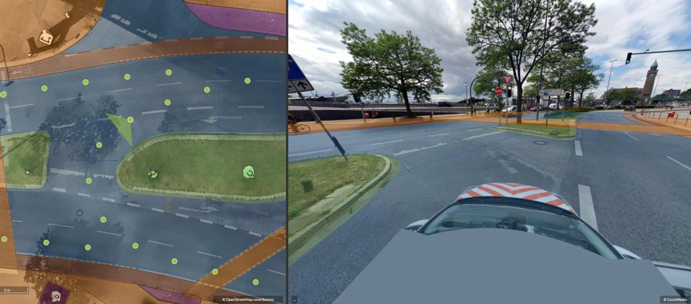
Surface Type Mapping
Identify and classify surface materials to support corridor planning, cost estimation, and construction readiness.
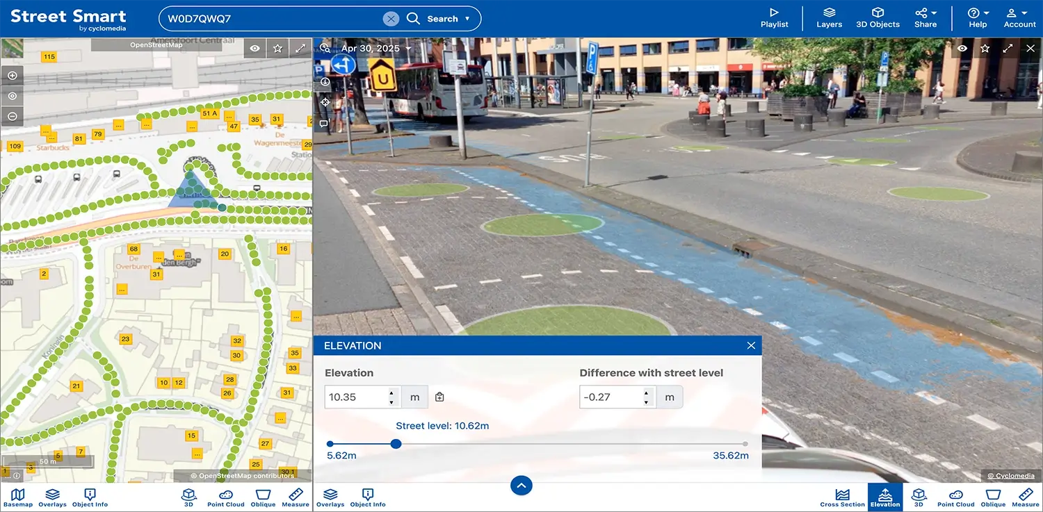
Elevation and flood risk analysis
Use elevation insights to understand drainage patterns and assess flooding risk when planning infrastructure works.
Solutions that strengthen pavement and surface decisions
Combine 360° imagery, LiDAR Data, and structured datasets to build a reliable foundation for pavement assessment, surface analysis, and long-term infrastructure planning and maintenance workflows.
Area mapping
Map surface materials and classifications to support permitting, corridor design, and project scoping.
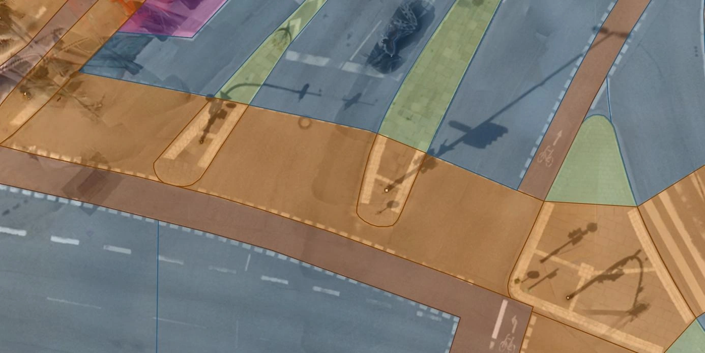
Road surface analysis
Analyse surface characteristics and materials using imagery and spatial context.
Elevation tool
Use elevation data to evaluate drainage behaviour and potential flood exposure.
Surface measurements
Extract consistent measurements from imagery and LiDAR Data for engineering and design tasks.
Flooding risk insights
Understand how surface levels and materials influence local flooding vulnerability.
Underground works planning
Use surface and elevation insights to plan excavation, utilities, and reinstatement with fewer unknowns.
Corridor planning support
Support road and multimodal corridor planning with consistent surface and condition data.
Environmental preparedness
Leverage elevation and surface insights to strengthen mitigation strategies and climate‑resilient design.
Infrastructure intelligence
Combine surface, elevation, and condition data to support informed infrastructure