Capture.
Insight.
Intelligence.
Vision.
We capture the world in unmatched detail, turning reality into insights that saves time and cost and helps governments and companies operate smarter and safer.
Cyclomedia is a global leader in geospatial data and intelligence, transforming how organizations capture, visualize, and analyze the built environment.
Cyclomedia digitizes the outside world at scale. Using highly accurate street‑level imagery and LiDAR data and AI-powered analytics, we create reliable digital representations of cities and infrastructure that support planning, maintenance, and public safety. We empower governments and businesses to make smarter, data-driven decisions.
Our data helps professionals assess assets remotely, reduce field visits, and make decisions based on consistent, measurable information rather than fragmented local surveys or outdated records.

Discover our comprehensive suite of geospatial solutions designed to support public space and infrastructure management.
Cyclomedia provides a connected set of geospatial assets that help organizations understand, analyze, and manage the outdoor environment. From captured data to visualization, insight, and system integration, each asset plays a distinct role in turning real‑world conditions into reliable information for professional decision‑making.
Data
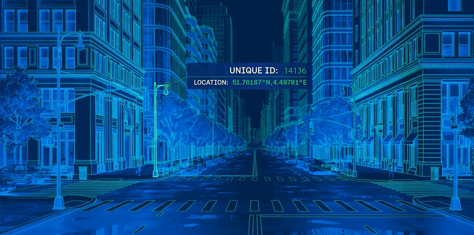
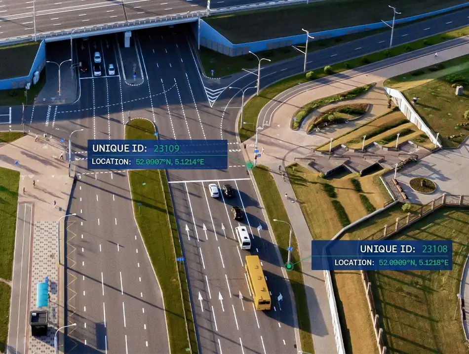
High‑accuracy street‑level imagery (Cyclorama's) and LiDAR point clouds create a consistent and measurable digital representation of public space. These datasets form the foundation for inspection, measurement, comparison over time, and large‑scale analysis without repeated site visits.
Insights
Cyclomedia transforms geospatial data into structured and usable insights. Automated analysis supports objective assessments, scalable asset inventories, and consistent decision‑making across departments and regions.

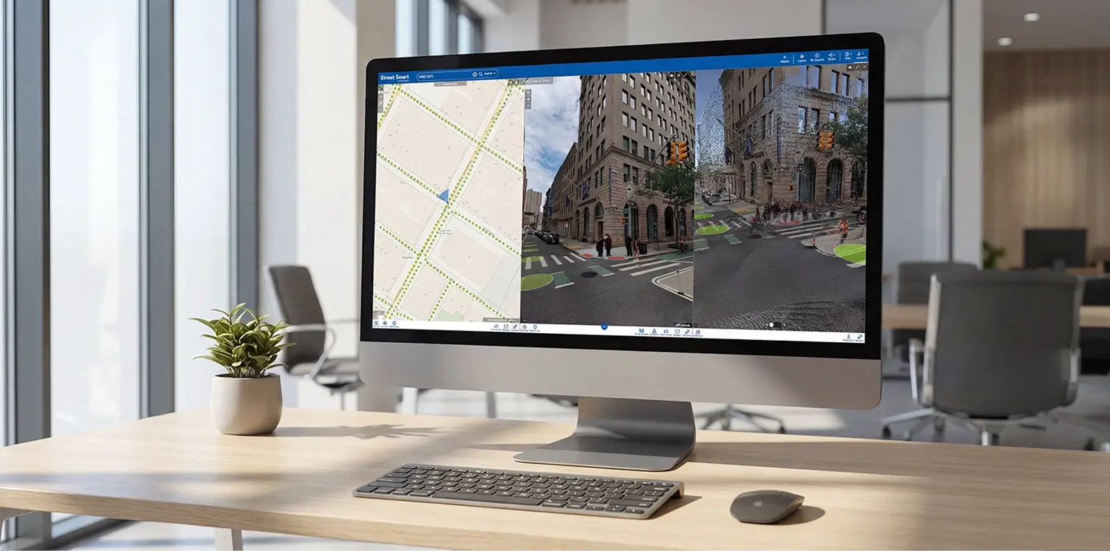
Street Smart®
Street Smart® is the central environment for viewing, measuring, and comparing geospatial data. It enables professionals to inspect assets, validate conditions, and analyze change directly from their desktop using reliable visual and spatial context.

Integrations & APIs
Open integrations and APIs connect Cyclomedia data with existing GIS, asset management, and enterprise systems. This ensures accurate and consistent information flows across tools, teams, and workflows.
Delivering tailored geospatial solutions across diverse sectors with proven expertise and innovative technology.
Organizations across the public sector and infrastructure domain rely on Cyclomedia to understand and manage real world conditions. Our solutions support industry specific workflows while providing a shared and consistent foundation for collaboration, analysis, and long term planning.

Construction & engineering
Construction and engineering teams use Cyclomedia to gain early insight into site conditions, surroundings, and constraints before work begins. Accurate spatial data and remote measurements support design validation, reduce rework, and improve coordination across planning, engineering, and delivery phases.

Government
Public authorities use Cyclomedia to manage streets, buildings, and public assets more efficiently. Accurate geospatial intelligence supports asset management, inspections, permitting, and urban planning while reducing reliance on manual surveys and repeated site visits.

Transportation
Infrastructure owners and operators rely on Cyclomedia to manage linear and area‑based assets throughout long life cycles. A complete digital representation of the outdoor environment supports investment planning, coordination, and long‑term asset strategies.
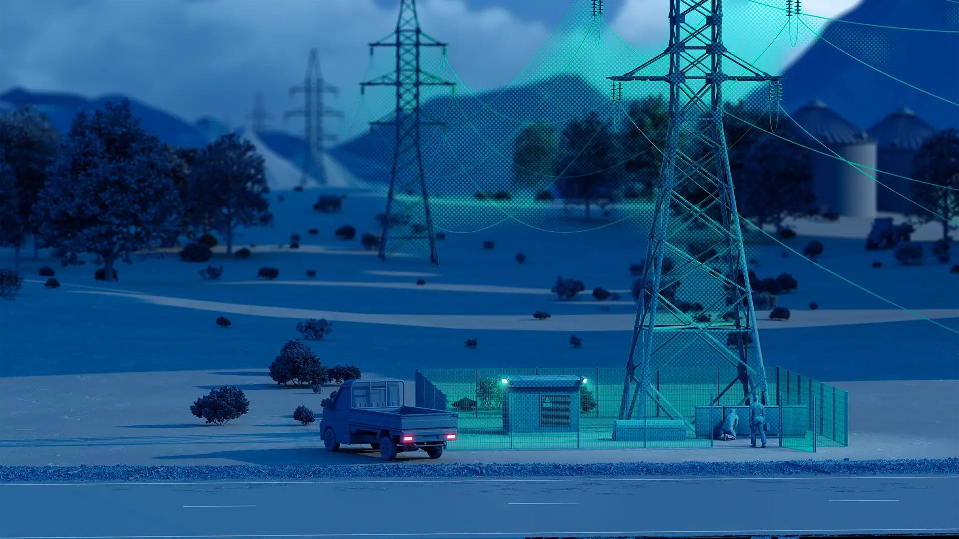
Utilities & energy
Utility and energy providers use Cyclomedia to plan, inspect, and manage networks more effectively. Reliable insight into assets and their surroundings supports maintenance planning and network expansion while reducing operational risk.

Telecommunications
Telecommunications providers use Cyclomedia to assess locations, surroundings, and physical constraints during network planning, permitting and rollout. Remote insight enables faster evaluations and more confident deployment decisions.

Insurance
Insurance organisations use Cyclomedia to support assessment and validation workflows. Objective visual evidence and spatial context improve transparency, consistency, and efficiency when reviewing locations, properties, and risk factors.
Comprehensive geospatial solutions designed to address your most critical infrastructure and operational challenges.
Asset management:
Centralize asset inventories with accurate street-level imagery, LiDAR, and AI-derived attributes to monitor condition, plan maintenance, and reduce field inspections across the entire asset lifecycle.
Pavement & surface:
Automatically detect pavement defects, surface types, and deterioration using high-resolution imagery and AI to support maintenance prioritization, budget planning, and network-level condition assessments.
Smart city:
Create a shared digital representation of public space that enables cross-department collaboration, data-driven planning, and consistent decision-making using objective, up-to-date geospatial data.
Tax assessment:
Support fair and defensible property valuations with current visual evidence and measurements, reducing reliance on site visits while improving accuracy, transparency, and review efficiency.
Pedestrian safety:
Identify, measure, and assess sidewalks, curb ramps, crosswalks, and streetscape assets to support accessibility compliance, risk reduction, and safer public spaces without extensive fieldwork.
Road safety:
Analyze road environments, signage, markings, and surrounding context at scale to support safety audits, risk assessments, and targeted improvements based on consistent visual and spatial data.