Cyclomedia GeoCyclorama® Imagery
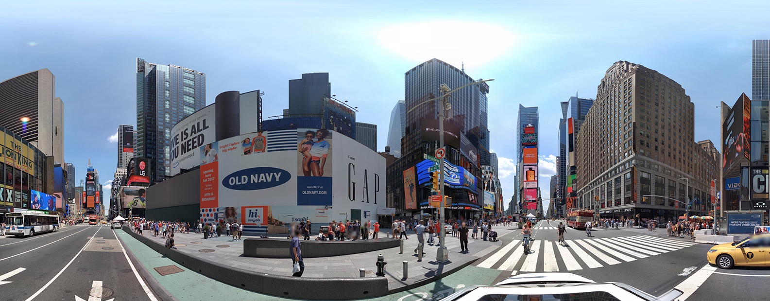
The Cyclomedia GeoCyclorama® is a 360° panoramic photograph captured in ultra-high resolution, offering a reliable and objective digital representation of public spaces from street level. The exceptional quality and resolution of GeoCyclorama® imagery allow users to see fine details, such as house numbers, infrastructure features, and the condition of assets or real estate. With this imagery, users can view, assess, and analyze these details remotely, eliminating the need for on-site visits and enhancing efficiency in decision-making and planning.
Cyclorama

Thanks to its unique camera and patented processing techniques, GeoCyclorama® imagery offers exceptional accuracy, with precise location and orientation information embedded (geo-referencing). This level of detail enables highly accurate measurements, ensuring reliable data for analysis.
GeoCyclorama® imagery is captured systematically and at a large scale, with images taken at regular intervals of 16.4 feet (5 meters) along all public roads accessible by vehicle. This comprehensive approach ensures wide coverage and consistency, making it an invaluable resource for a variety of applications.
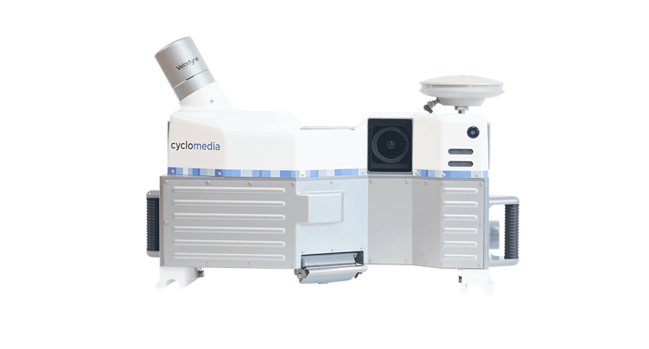
Cyclomedia’s imaging system captures five individual images at each recording location, which are then seamlessly stitched together to create a parallax-free GeoCyclorama®.
GeoCyclorama® imagery, either on its own or combined with other geographical and administrative data (provided by Cyclomedia or the end user), serves as a critical information source for a wide range of processes in both government and business. The high positional accuracy enables users to overlay existing data layers directly onto the images, making it easier to view, analyze, and edit information.
GeoCyclorama® imagery is managed through Cyclomedia’s online database, accessible via the Street Smart® platform as a service solution, providing users with a simple and efficient way to access and work with their data.
Street Smart®: Easy Access to GeoCyclorama® Imagery
Cyclomedia’s Street Smart® platform provides a user-friendly, web-based interface to access GeoCyclorama® imagery. With this platform, users can easily explore images and data, view both current and historical visuals, and compare changes over time. Tools like Measure Smart allow for quick and accurate measurements of objects and distances. The platform also includes multiple data layers, enabling users to view additional contextual information, making analysis and planning even more efficient.
By combining the power of GeoCyclorama® imagery with the intuitive Street Smart® platform, Cyclomedia empowers users to remotely inspect and evaluate public spaces with exceptional accuracy and speed, streamlining decision-making and project management.
How GeoCycloramas Work with ArcGIS
GeoCyclorama® imagery seamlessly integrates with Esri’s ArcGIS software, offering users enhanced capabilities for spatial analysis. Cyclomedia provides the Street Smart Widget for ArcGIS, enabling users to combine GeoCyclorama® imagery with their own geographic data. This integration simplifies the process of analyzing maps, creating reports, and making informed decisions based on real-world visuals.
With ArcGIS, users can overlay GeoCyclorama® imagery with valuable data, such as zoning details or public works information. This powerful combination supports planners, government officials, and businesses in better managing projects, improving efficiency, and making more informed decisions at every stage of development.
Who benefits from GeoCyclorama® imagery?
GeoCyclorama® imagery is a valuable tool across various industries. City governments can remotely assess public infrastructure, significantly reducing the time and costs associated with field visits. Real estate companies can examine property conditions and surrounding areas without the need for on-site inspections. Utility companies can monitor power lines and gas pipes from a computer, streamlining asset management and improving efficiency.
In infrastructure management, maintaining roads, bridges, and utilities is essential for public safety. Traditionally, inspectors would need to visit each site to assess the condition of roads, sidewalks, or utility poles, a time-consuming task, especially in large or remote areas.
With GeoCyclorama® imagery, infrastructure managers can conduct these assessments remotely. The 360° high-resolution images capture fine details, such as cracks in roads or signs of erosion. For example, city planners in the Netherlands use GeoCyclorama® imagery to evaluate bike lanes, enabling them to quickly identify areas in need of repair and compare current conditions with historical data to plan maintenance more effectively.

Cyclorama Building for Public Works Management
City departments responsible for utilities, waste collection, and public space management rely on GeoCyclorama® imagery to streamline their operations. With this technology, they can remotely inspect critical infrastructure, such as water lines, tree growth near power lines, and public spaces, without the need for constant on-site visits. By comparing recent and historical images, departments can quickly identify areas at risk of flooding, enabling faster decision-making and prioritization of urgent issues. Integrating GeoCyclorama® imagery with tools like ArcGIS enhances its capabilities, allowing users to overlay additional information, such as the location of underground pipes or utility lines, for more comprehensive analysis and better-informed planning.

Real Estate, Property Appraisal, and Urban Planning
For real estate developers and urban planners, having accurate, up-to-date information is essential for making informed decisions. GeoCyclorama® imagery provides high-resolution, street-level views that allow users to virtually explore sites without the need for on-site visits, saving valuable time and resources. Developers can assess locations remotely, while planners can track changes over time, ensuring compliance with zoning regulations. Additionally, GeoCyclorama® imagery supports construction monitoring, helping planners verify that projects are progressing as planned and meeting regulatory standards.

Government and Law Enforcement
Local governments and law enforcement agencies rely on GeoCyclorama® imagery to monitor public spaces and enforce regulations efficiently. With high-resolution, street-level visuals, officials can remotely inspect traffic signs, investigate incidents, and review areas for potential violations without deploying officers for every case. GeoCyclorama® imagery also aids in managing busy intersections by ensuring traffic signs are properly placed and clearly visible, helping to reduce accidents and improve road safety. Additionally, emergency responders can use the imagery to assess locations in advance, identify potential obstacles, and navigate more effectively—enhancing response times and assisting in locating individuals when needed.
A future-proof solution
GeoCyclorama® imagery is built with cutting-edge technology, ensuring long-term reliability and seamless performance. The system automatically optimizes data capture frequencies, eliminating technical concerns, while USB-C charging and effortless integration with ArcGIS make it a future-proof solution for businesses and government agencies alike.
Cyclomedia’s GeoCyclorama® imagery, combined with the powerful Street Smart® platform, provides users with easy access to high-resolution, street-level imagery for accurate analysis of streets and public spaces. Whether you're a city planner, real estate developer, or utility manager, these tools simplify project assessment and management. Plus, with ArcGIS integration, you can unlock advanced data analysis capabilities for smarter decision-making. GeoCyclorama® imagery delivers the clarity, efficiency, and innovation you need.