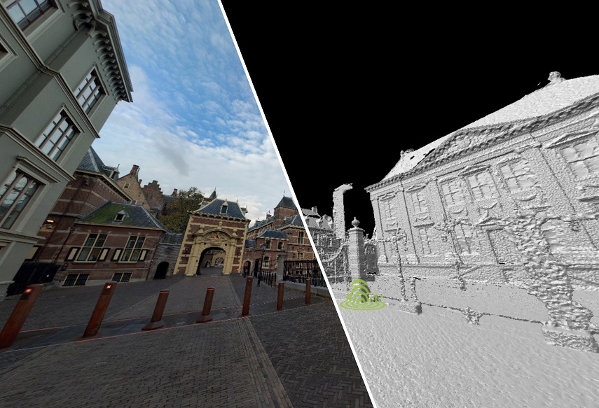
Lidar point cloud header

Cyclomedia LiDAR point cloud

The Cyclomedia LiDAR Point Cloud is a high-density three-dimensional point cloud. Cyclomedia leverages the benefit of capturing LiDAR data simultaneous to capturing our GeoCyclorama imagery to ensure the highest level of both quality and accuracy. We further enhance the LiDAR data by processing it with our proprietary CycloPositioner software to increase its positional accuracy and to perfectly align with our imagery. This, together with the natural colors processed in the point cloud from our GeoCycloramas, makes the LiDAR Point Cloud a photorealistic, fully three-dimensional source of information for geo-referencing.

Having LiDAR data available also enables the use of Cyclomedia’s Measure Smart tool, which takes advantage of the 3D GeoCyclorama layer produced from the point cloud, making measuring in GeoCycloramas very easy. 

Try for free
LiDAR Point cloud GeoCyclorama

LiDAR Point cloud

GeoCyclorama

The LiDAR Point Cloud is available for viewing in Street Smart

Parts of the point cloud can also be downloaded for use in other software applications, such as CAD and BIM packages. You can select an area on the map and download a LAZ file for further processing in other applications. By using LiDAR technology and our expertise in handling spatial data, we help organizations minimize errors and optimize their processes, leading to better decision-making and more efficient project execution. Discover more about Street Smart, our interactive web viewer.

Applications

Cyclomedia's point cloud data offers a wide range of applications in urban planning and construction projects. An example is using point clouds generated from remote sensing technologies like LiDAR point data. With those, it's possible to create 3D visualizations that offer detailed insights into public spaces. These point clouds are invaluable in planning future developments, making sure that all stakeholders, from citizens to contractors, have a clear visual representation.

By overlaying 3D designs onto point cloud data, public projects become more transparent and accessible to all involved, facilitating smoother workflows and better planning. The Cyclomedia LiDAR Point Cloud offers added value in the following exemplary work processes. among others:

3D visualizations for projects in public spaces
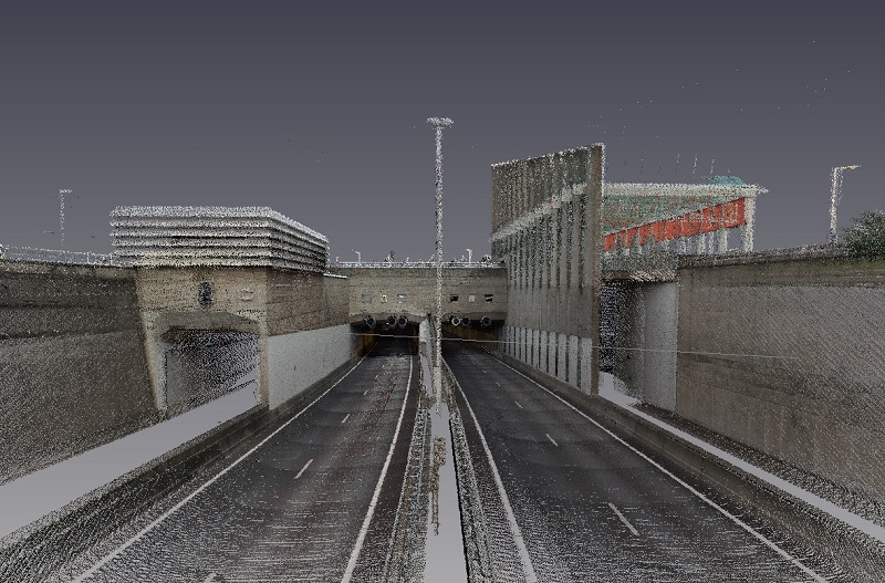
The Cyclomedia LiDAR Point Cloud enables you to visualize public space in 3D in an easy and accessible way. By combining the point cloud with 3D designs of future projects there is a lot to gain in terms of communication towards citizens, within project groups and between client and contractor. This allows you to keep project delays to a minimum.

It also incorporates terrestrial laser scanning and light detection methods to capture and represent spatial data with incredible accuracy. When you use point cloud processing, you can combine raw data with future designs to present a complete picture of public spaces. This level of detail allows for easier communication with stakeholders and ensures that everyone is on the same page. The ability to use point cloud files in this way reduces the chances of errors and makes long-term urban planning more efficient and transparent.

Measuring and mapping

Because of the high relative accuracy ( < 1") it is possible to measure and map directly in the point cloud in 3D. All regular GIS and CAD software has the possibility to import our point cloud. The use of the Cyclomedia LiDAR Point Cloud makes maintenance of basic and core registrations faster and easier, increasing productivity.

By using high-resolution point clouds, generated from scanners that produce raw data, Cyclomedia enables precise measuring and mapping directly within a 3D environment. This enhances accuracy in the documentation of city infrastructure and the management of urban assets. The integration of point cloud data into common GIS and CAD software allows for easier workflows, streamlining point cloud processing and reducing the time required for maintaining core and basic registrations. This boost in productivity is particularly useful for infrastructure projects, where point cloud files can speed up planning and improve decision-making.

Public space management and asset management
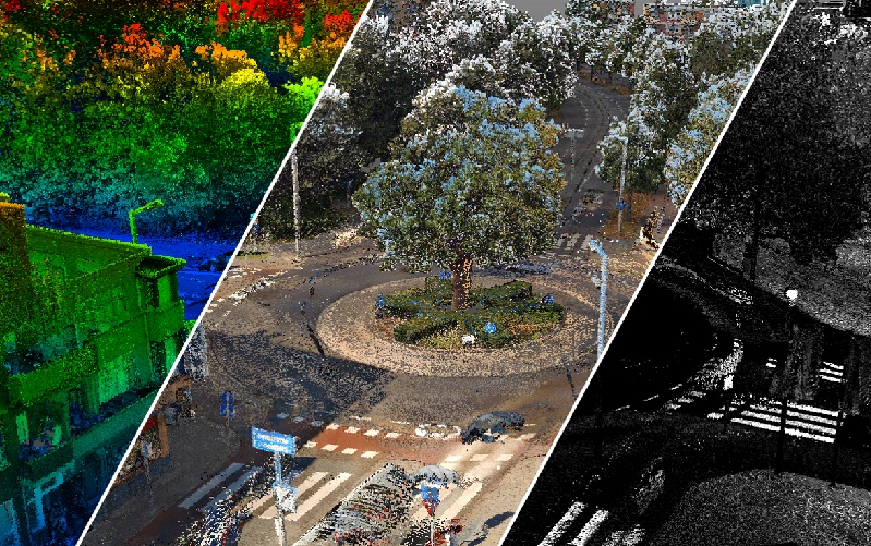
Its high accuracy and photorealistic character makes the Cyclomedia LiDAR Point Cloud very suitable for performing tasks in public space management. Whether it concerns vegetation analysis, inventory of objects (road markings, traffic signs, street furniture) or flooding and drainage simulations, the point cloud is a very valuable data source.

For public space and asset management, the point cloud data provided by Cyclomedia offers unmatched detail and precision. Whether you are conducting a vegetation analysis, inventorying street furniture, or analyzing road conditions, the LiDAR point cloud provides essential information. By utilizing terrestrial laser scanning technologies, the point cloud makes sure that all objects in public spaces are recorded with incredible accuracy. The ability to simulate potential flooding or drainage issues based on point cloud insights helps municipalities make proactive, data-driven decisions, enhancing the management and upkeep of public infrastructure.

Real estate appraisals and valuations

Based on the Cyclomedia LiDAR Point Cloud it is very easy to construct the contours of existing buildings in 3D. This makes it possible to efficiently determine the volume of real estate objects to support the valuation process.

In real estate, the ability to use point clouds for constructing the 3D contours of buildings streamlines the valuation process. The high precision of lidar point data allows for exact measurements of building volumes, which is an important aspect for accurate appraisals. This data supports real estate professionals in representing spatial data and enables the comparison of different properties within a city. By incorporating point cloud files into point cloud processing, it is possible to generate detailed real estate models, reducing the time needed for manual measurements and improving the efficiency of property evaluations.

Public order and safety

The Cyclomedia LiDAR Point Cloud allows you to move freely in three dimensions and view locations from any perspective, enabling line of sight analysis. This makes it possible to easily plan and prepare security of large events. Other applications such as real-time monitoring of visitor flows, visualizing nuisance based on sensors, and simulating calamities reduce risks and contribute to maintaining public order and safety.
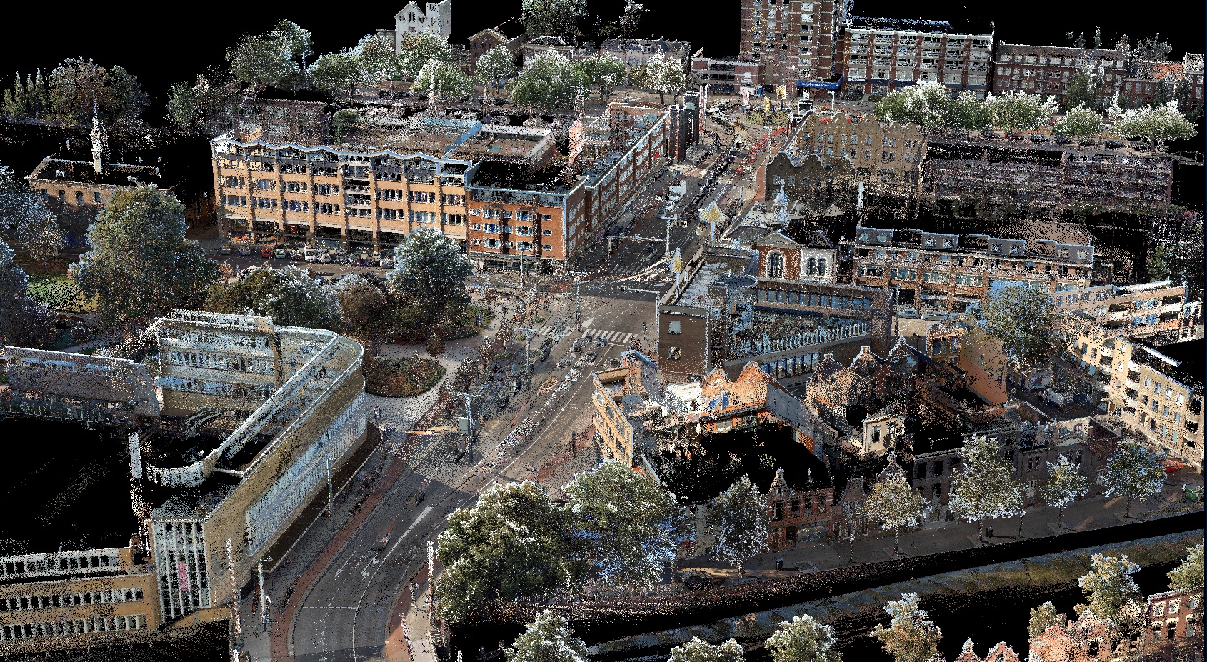
The Cyclomedia point cloud data is invaluable for public safety and urban planning, especially when it comes to representing spatial data for large events or emergency situations. Through remote sensing and light detection technologies, these point clouds enable authorities to perform line of sight analyses and simulate different security scenarios.

Our LiDAR technology and point cloud files provide extremely accurate measurements

This makes it easier to complete complex infrastructure projects faster and more efficiently. This includes mapping road networks, public utilities, and managing vegetation and other public space objects. In addition, our scanners produce raw data, which is processed into usable information through our advanced systems, making it accessible for engineers, urban planners, and real estate professionals.

Cyclomedia helps process and analyze this data by integrating it with common GIS and CAD software. Our tools support point cloud processing, giving you quick and efficient access to crucial insights needed to make informed decisions. Whether managing real estate portfolios, planning new infrastructure, or ensuring public safety at events, our LiDAR solutions offer the accuracy and reliability required for today’s urban development needs.

Point cloud data, point clouds and lidar data

Cyclomedia offers solutions that use point cloud data, LiDAR technology, and advanced spatial data processing to map urban and public spaces with high accuracy. By using light detection and ranging (LiDAR), millions of data points are captured through reflected laser pulses.

These points are then processed into a single point cloud, creating a detailed 3D representation of the environment. Cyclomedia’s terrestrial laser scanner allows us to collect this data with incredible precision, which is essential for city planning, public safety, and real estate management.

Sign up for a free trial