One platform to manage high-impact assets with confidence
Use accurate street-level imagery, LiDAR data, and integrated geospatial workflows to assess, track, and maintain critical assets across public space and utility networks—with fewer site visits and better decisions.


A complete, verifiable view of the assets that matter most
Asset teams often lack consistent, up-to-date information. Cyclomedia centralizes visual data, measurements, and asset attributes so departments work from the same verified source of truth. This reduces operational risk, streamlines inspections, and supports compliance across asset programs.

From field-heavy workflows to data-driven operations
Asset data is often incomplete, outdated, or stored across multiple systems. By combining Geospatial Data with visual evidence, Cyclomedia enables organisations to validate asset records, detect changes over time, and reduce uncertainty in inspections, compliance, and long-term planning.
Where Cyclomedia delivers asset management value
Our platform supports asset workflows across public space, utilities, and telecom networks. Each use case combines reliable data with practical inspection and planning tools that reduce field time and support informed operational decisions.

Public space asset inventory
Map and verify street furniture, road features, and trees using accurate imagery and LiDAR data to support maintenance planning and long-term oversight.
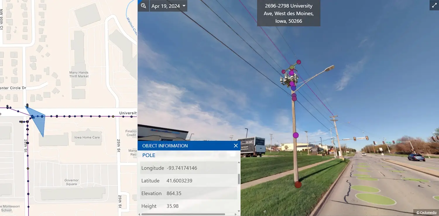
Utility & pole management
Assess poles, attachments, and network risks while supporting joint-use and makeready workflows with defensible visual asset data.

Tree asset monitoring
Identify tree-related risks, prioritize trimming, and reduce manual inspections by monitoring clearance conditions remotely over time.
Solutions that strengthen your asset workflows
Combine 360° imagery, LiDAR data, and measurement tools to create a dependable foundation for inspections, compliance, and long-term asset planning.
360° Street-level imagery
Access high-resolution visuals of key assets to support inventory creation, inspections, and documentation.
LiDAR point cloud
Use detailed 3D context to understand asset surroundings, assess risk, and support infrastructure analysis.
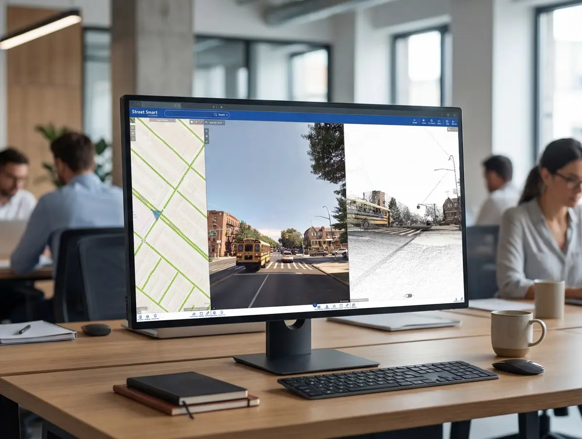
Cyclomedia Street Smart platform
A shared workspace for viewing imagery, verifying assets, and building comprehensive, consistent asset inventories.
Asset data extraction
Automated extraction delivers structured inventories for poles, trees, signs, and other visible infrastructure assets.
Tree insights
Identify tree proximity risks and prioritize trimming using reliable imagery and LiDAR-based visibility.
Pole inventory tools
Support pole identification and attachment verification with consistent, visual asset records.
GIS integrations
Connect imagery and LiDAR data directly to your GIS environment for consistent asset context and validation.
Change detection
Monitor asset changes over time to support maintenance cycles and compliance documentation.
Digital twin infrastructure
Use realistic 3D city models to support planning, scenario analysis, and infrastructure coordination.